10 fatalites result from extreme weather across Tennessee
By KATE COIL
TT&C Assisant Editor

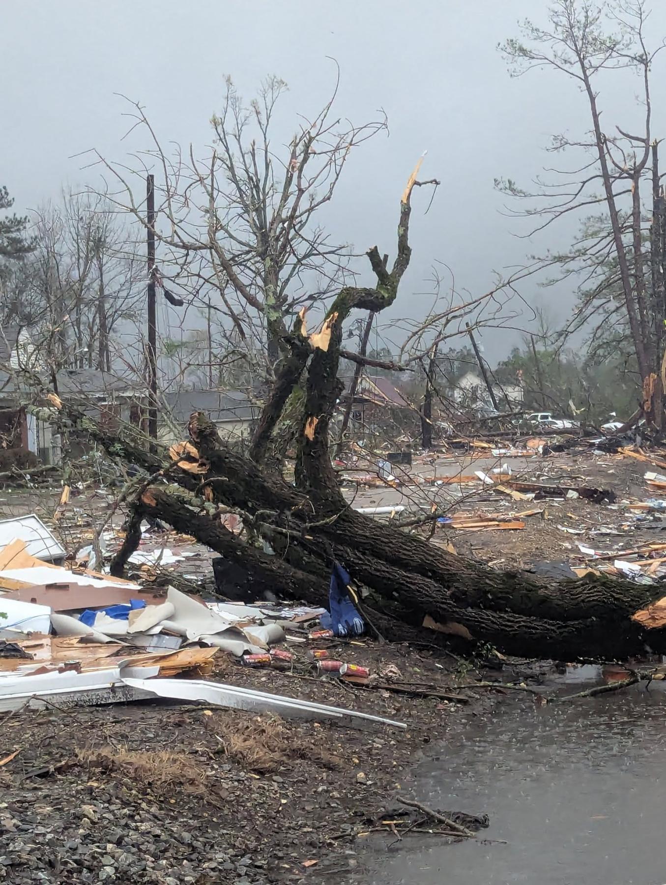
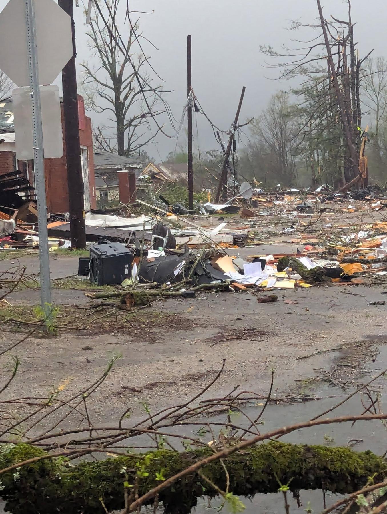
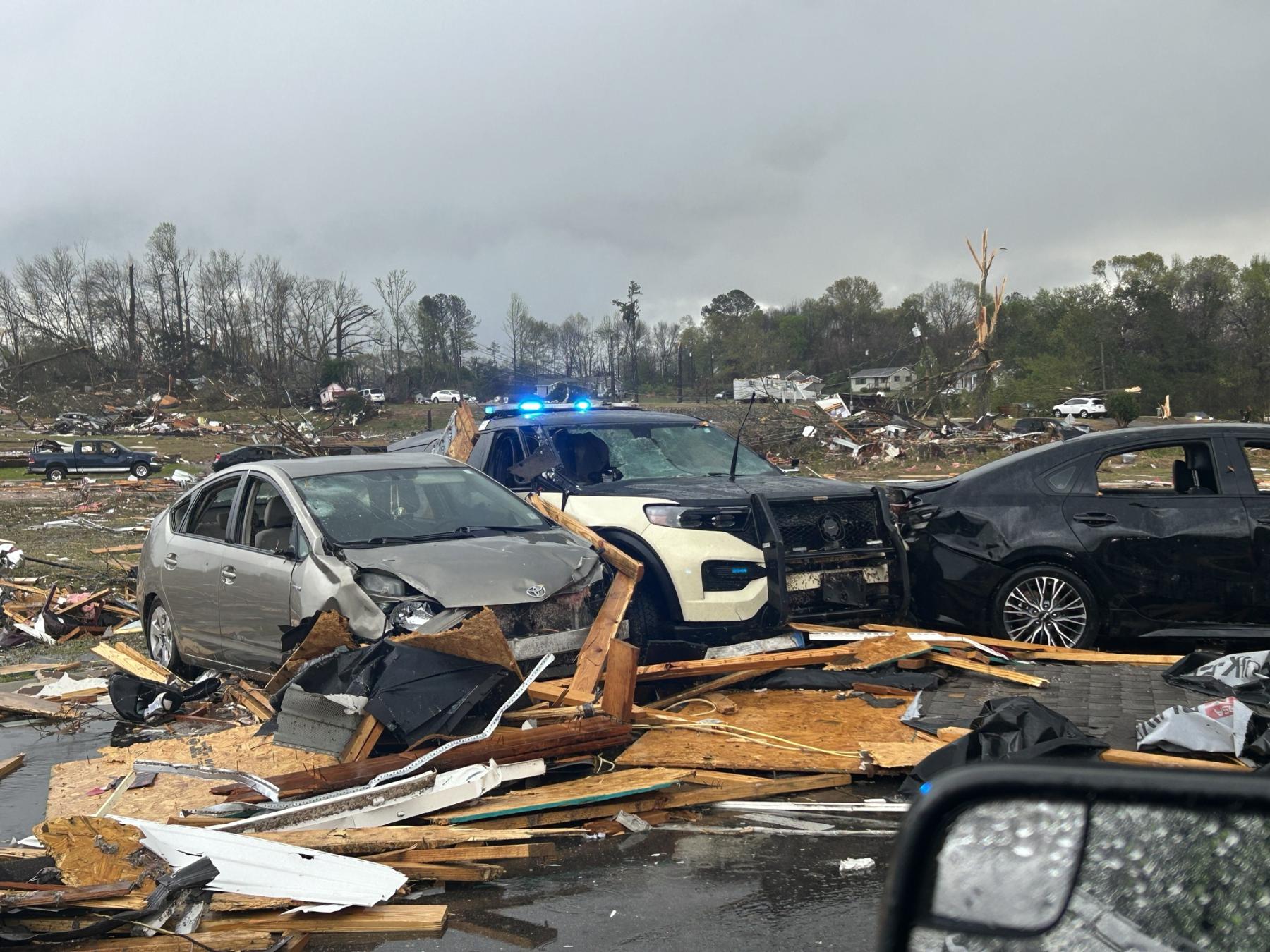
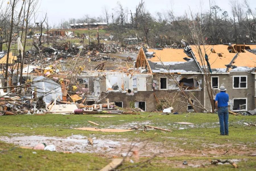
Ten deaths have been reported, and Gov. Bill Lee has declared a state of emergency following an overnight outbreak of tornadoes in the early morning hours of Thursday, April 3, and Saturday, April 5, and ongoing flash flooding across the state
In response to Gov. Lee’s state of emergency declaration, FEMA has been authorized to make federal disaster assistance available to supplement local response efforts in all 95 counties. Assistance will be provided for debris removal, emergency protective measures, and direct federal assistance.
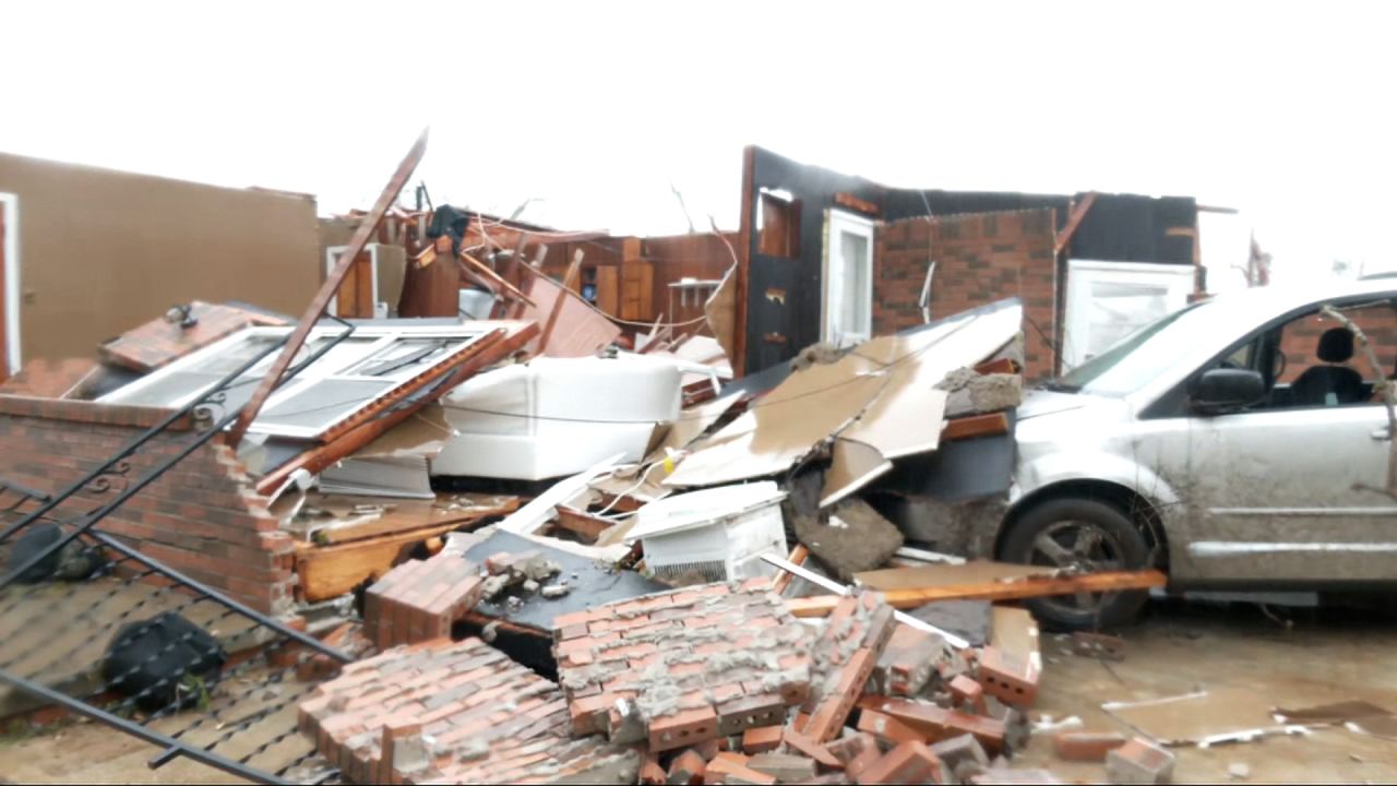
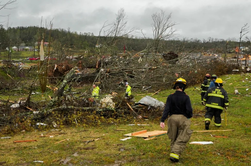
The Tennessee Emergency Management Agency (TEMA) confirmed 10 deaths in West Tennessee: one in Carroll County, two in Fayette, five in McNairy, one in Obion, and one in Tipton County. Tennessee reported the highest fatality rate from the storms with a total of 19 deaths reported nationwide.
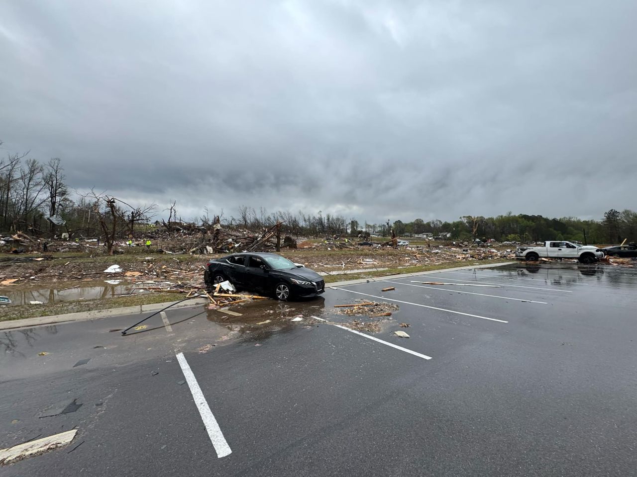
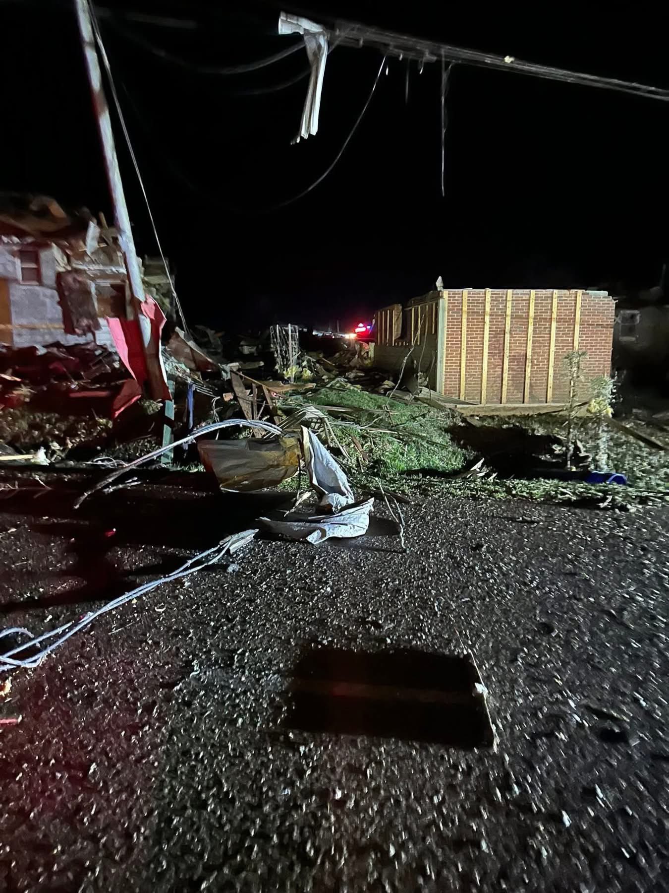
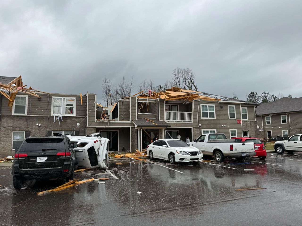
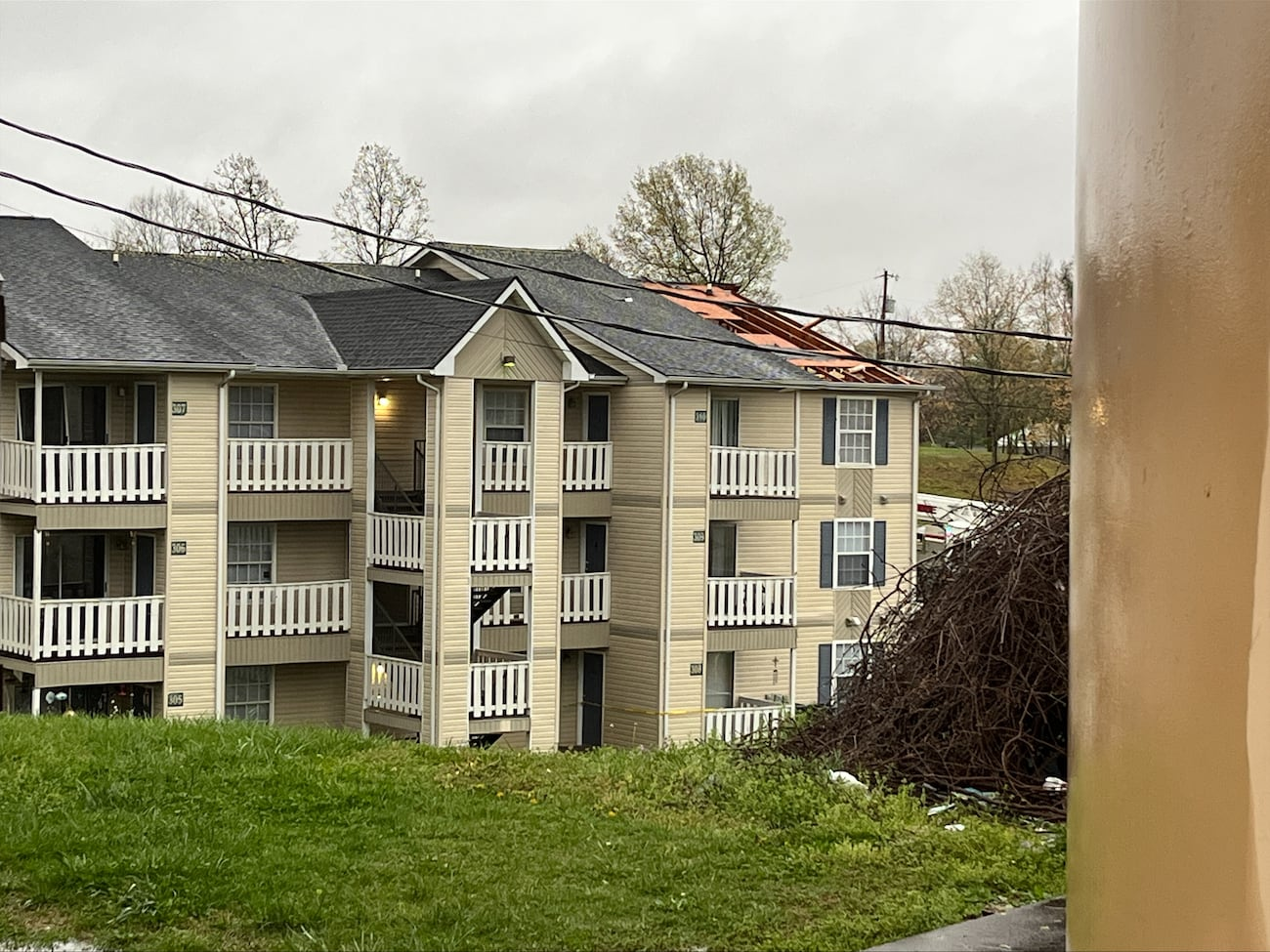
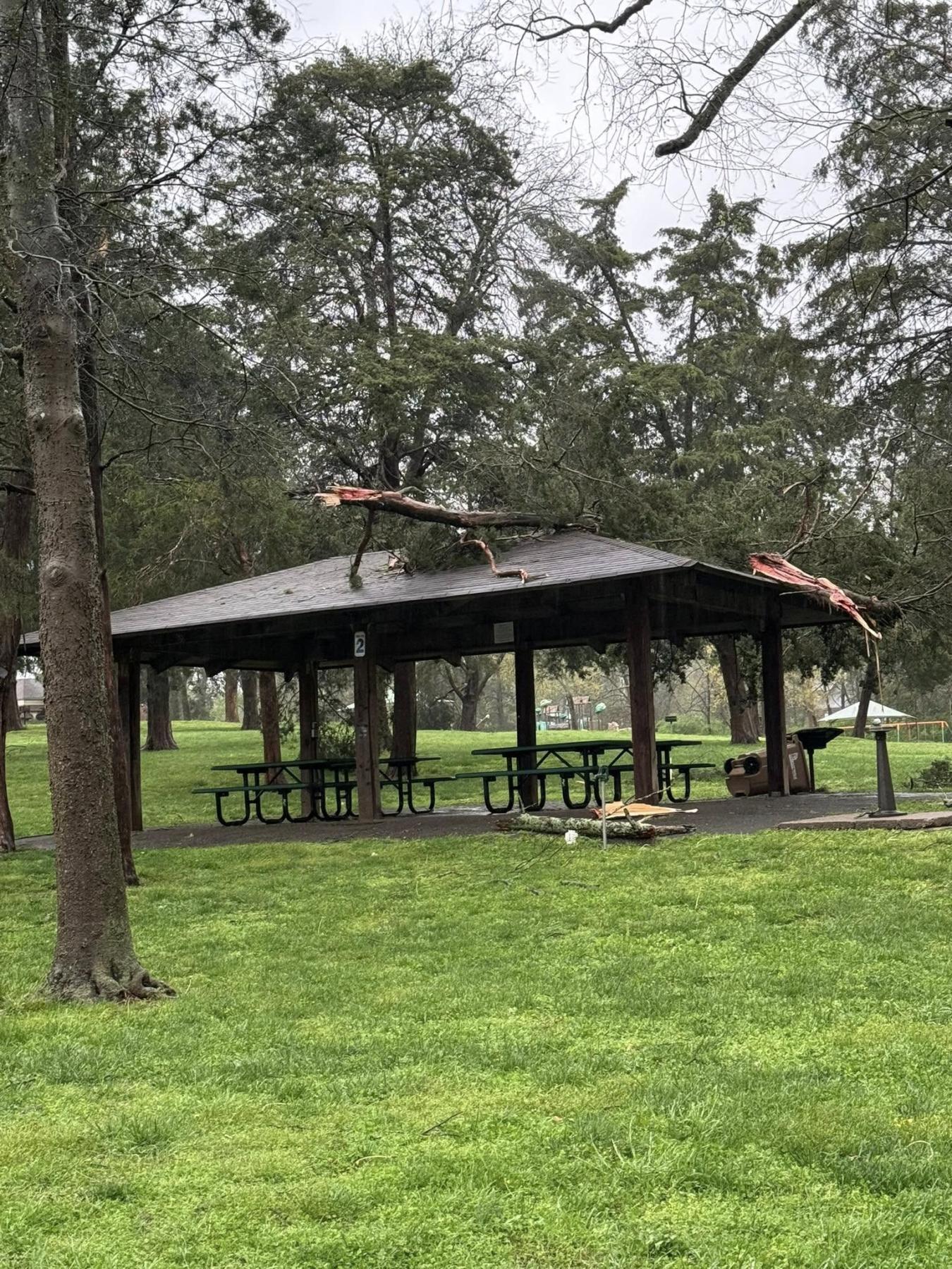
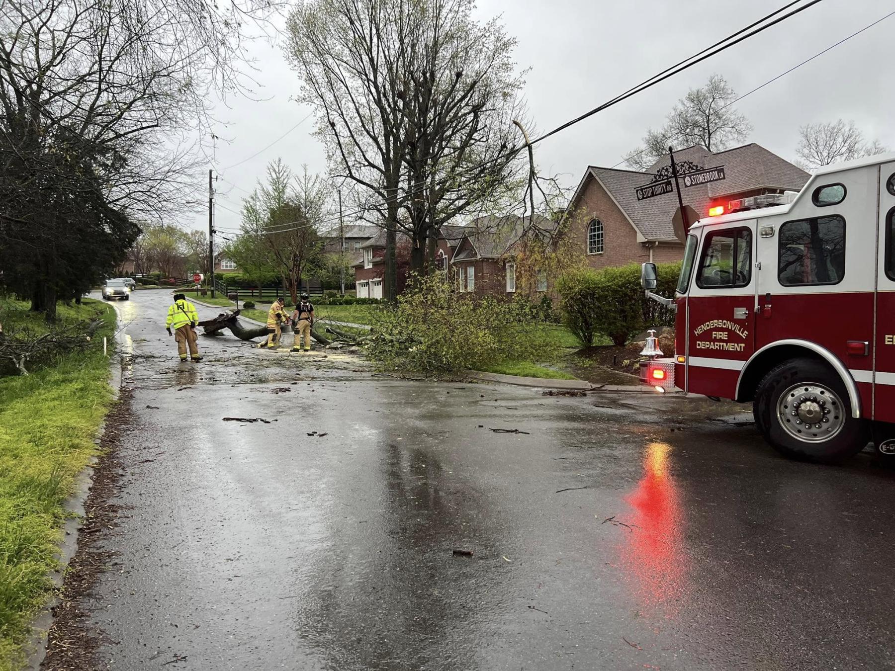
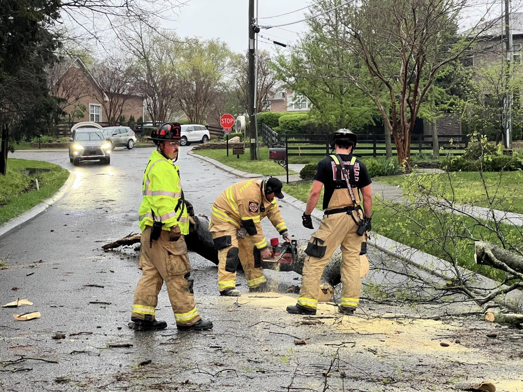
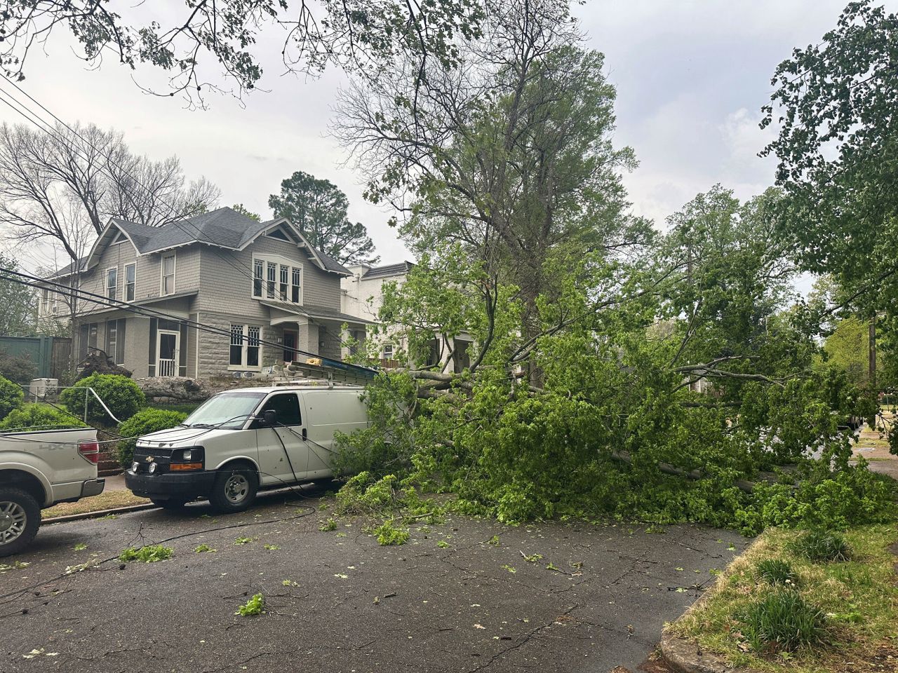
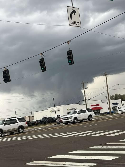
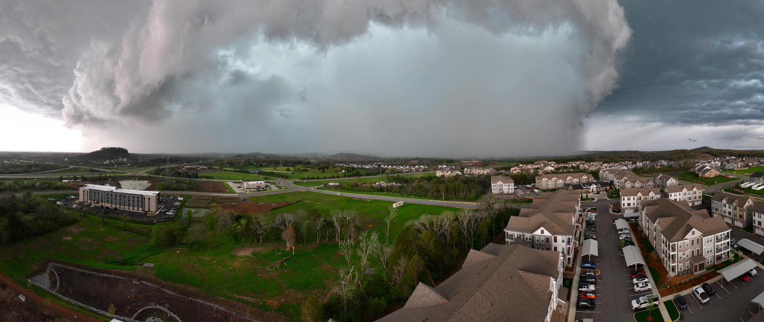
The National Weather Service (NWS) confirmed four tornadoes in West Tennessee and three tornadoes in Middle Tennessee on April 3. Nashville and Memphis both broke previous rain records for April 3 with Nashville more than doubling its previous record. Residents in Bartlett and Collierville reported receiving quarter-sized hail.
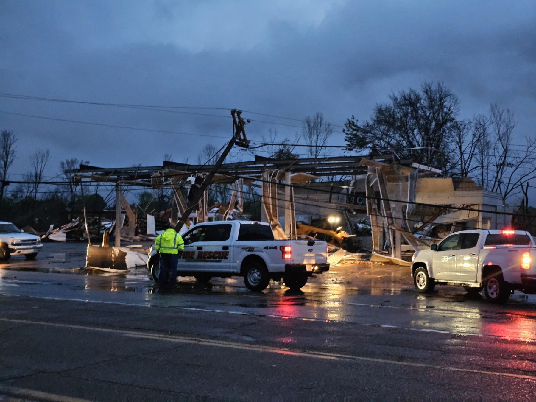
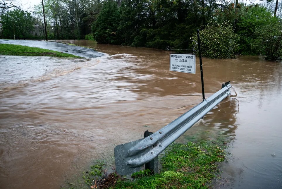
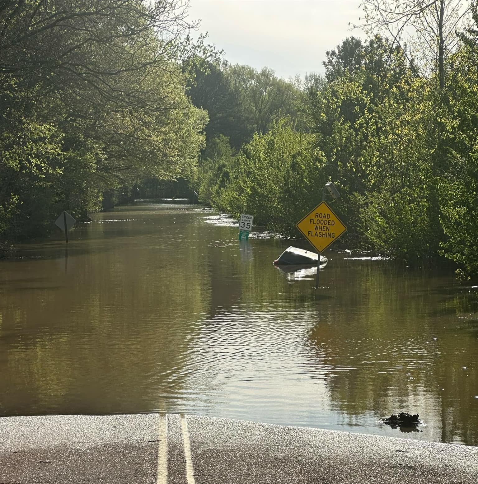
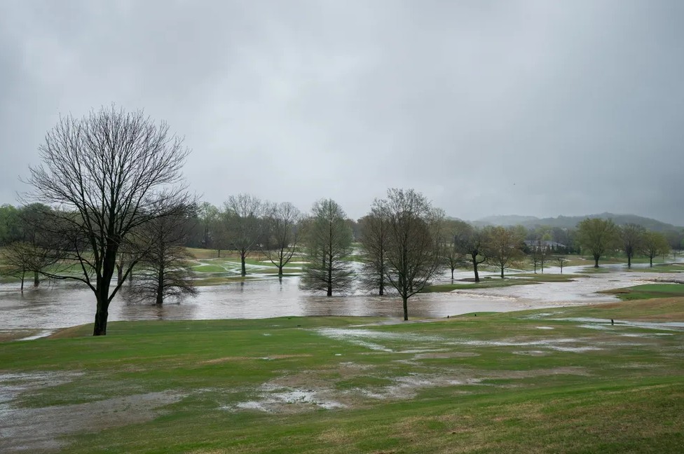
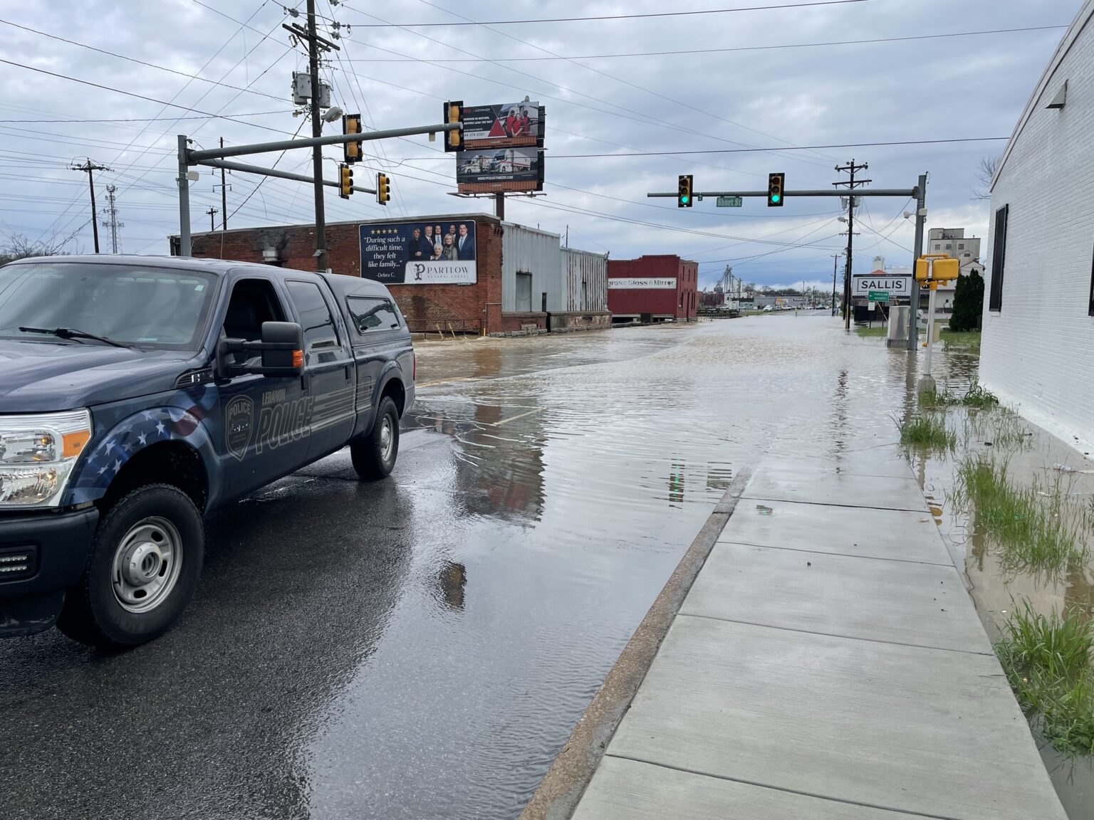
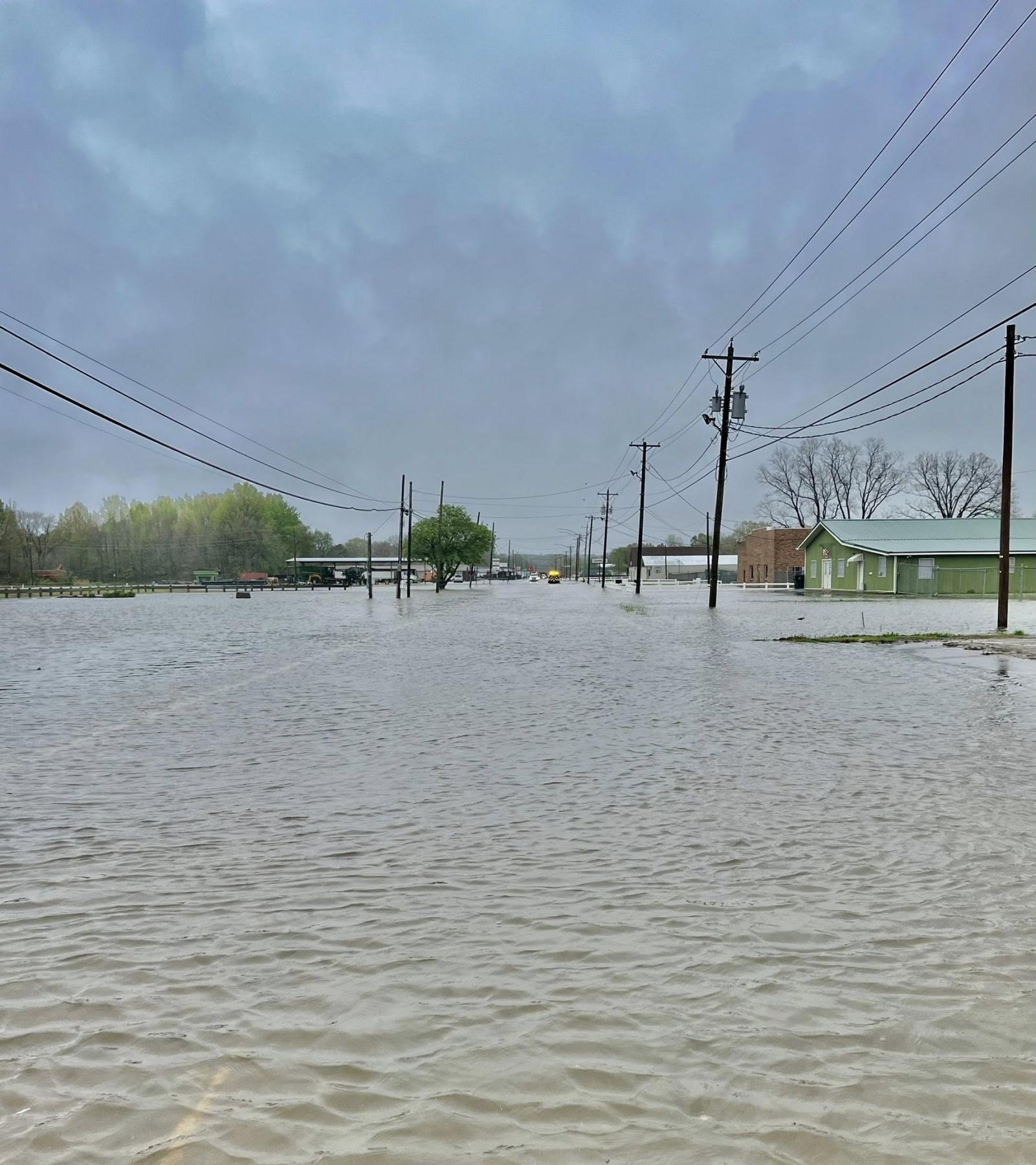
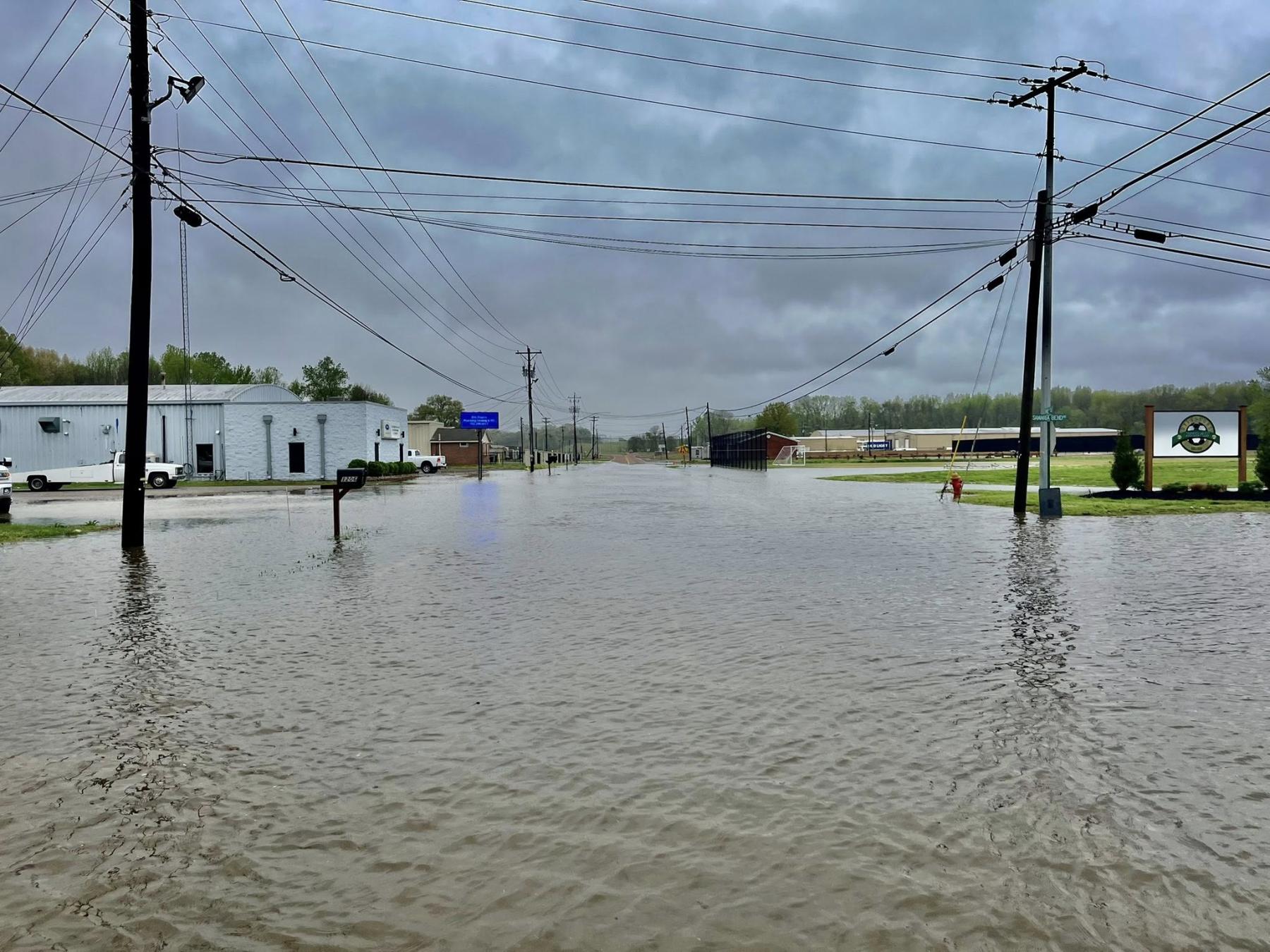
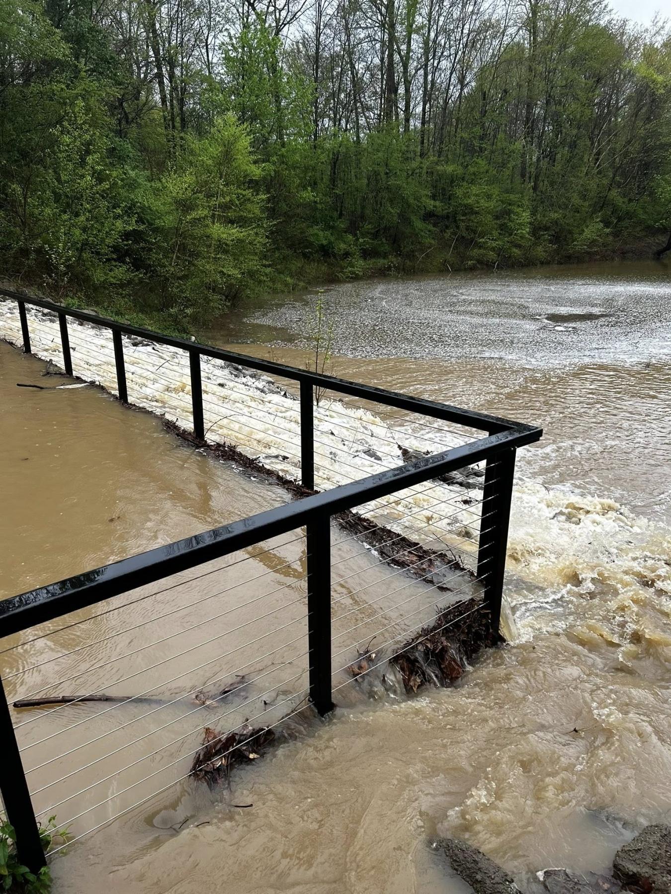
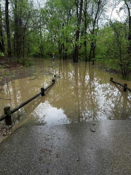
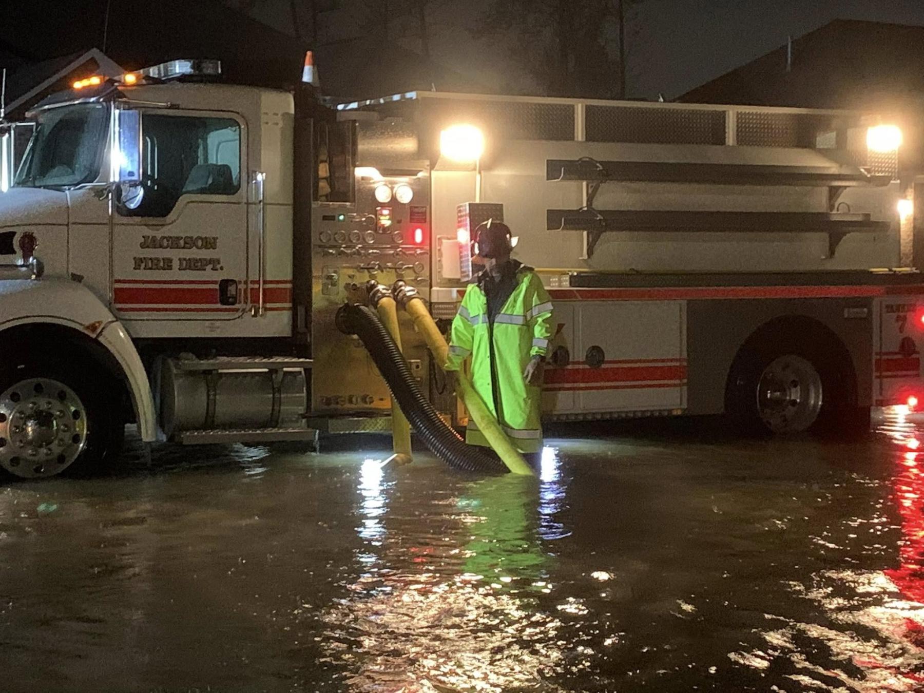
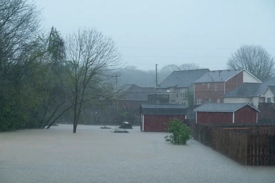
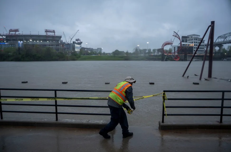
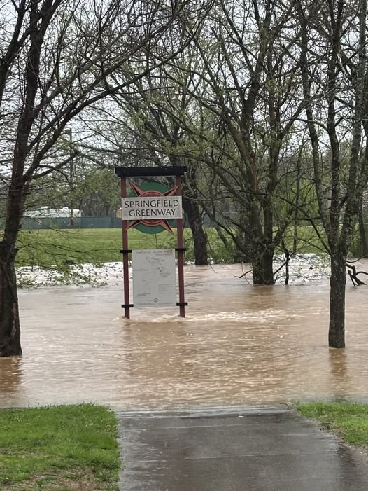
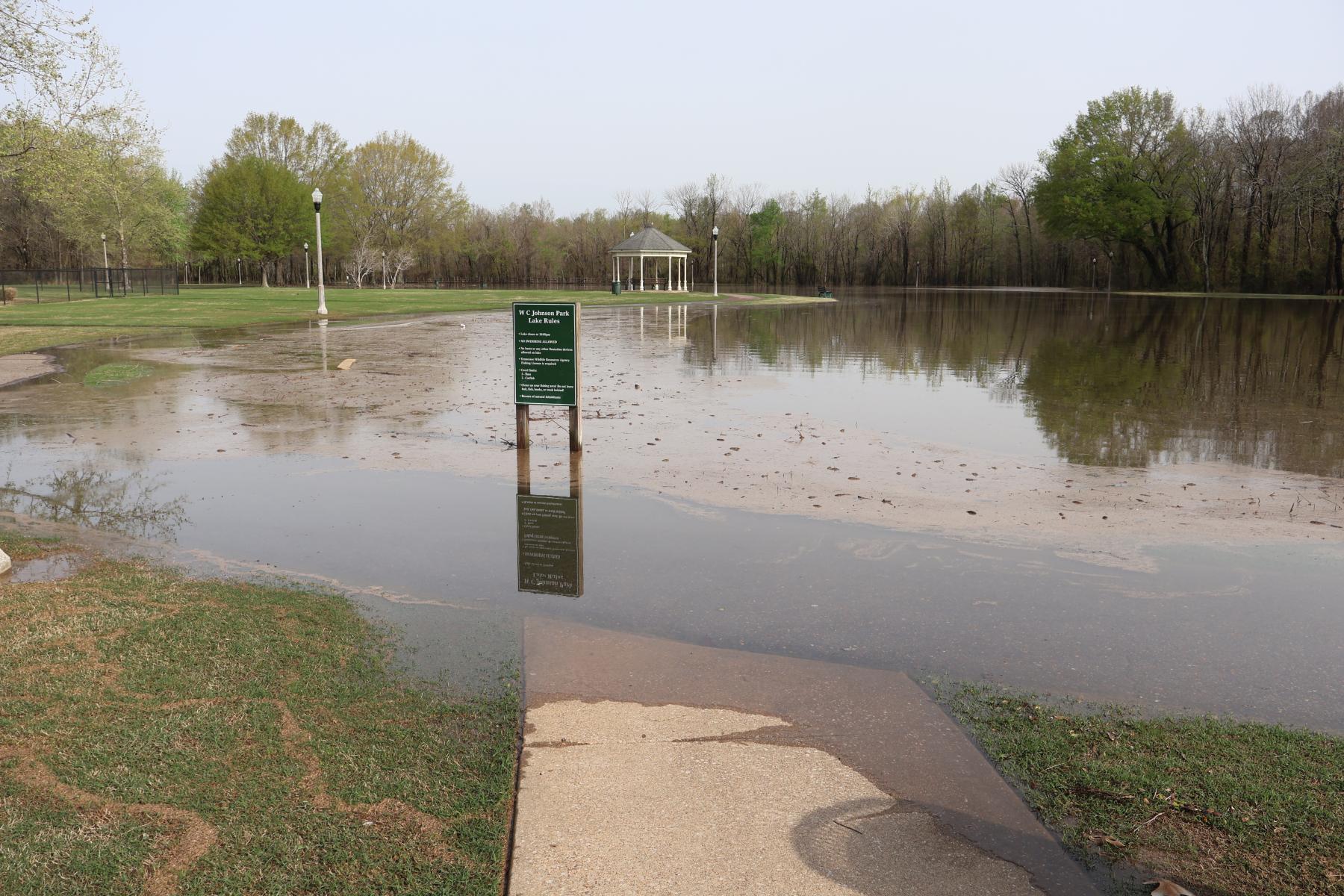
On April 5, a tornado was confirmed in Cross Plains with another confirmed near Lobelville. As of the morning of April 6, Clarksville had received more than 10 inches of rain with both the Cumberland and Red rivers overflowing their banks. The Cumberland in Clarksville crested in the evening of April 6 at 50.7 feet – above the 46-foot flood stage – and impacted numerous roadways. The Wolf River in West Tennessee reported its fourth-highest crest on record on April 6 with other waterways expected to crest in coming days.

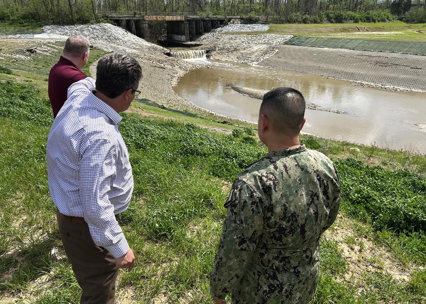
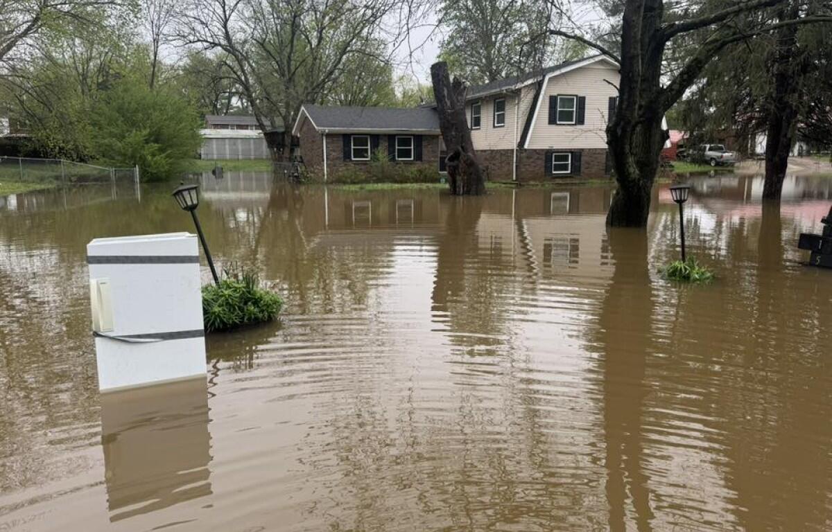
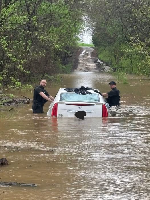
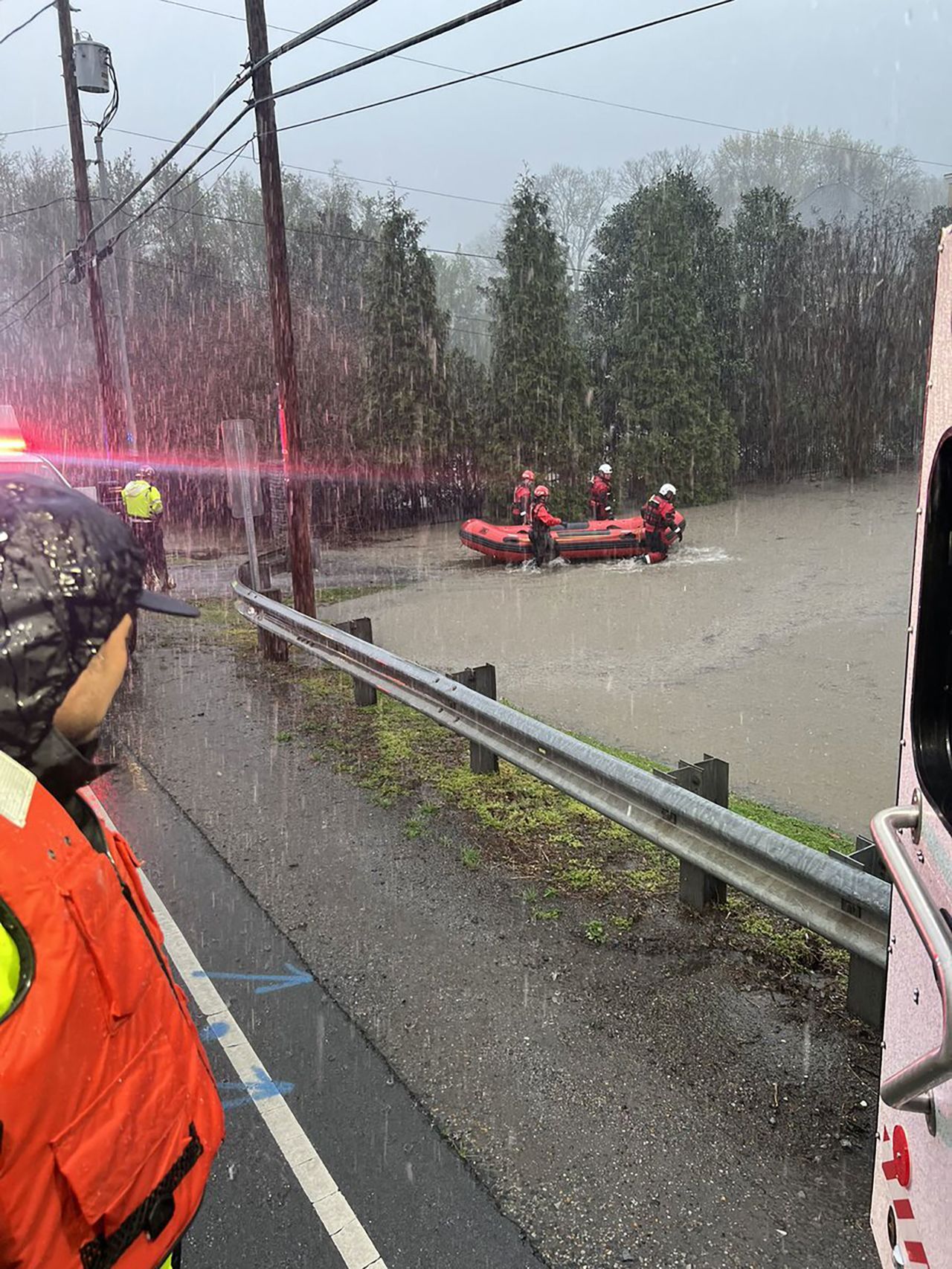
The town of Rives was inundated with floodwaters after the failure of a levee on the Mississippi River. Most residents were evacuated from the town after attempted repairs made by the U.S. Army Corps of Engineers did not hold. Other flooding-related evacuations and swift water rescues were reported in Nashville, Montgomery County, and Obion County. The NWS also stated they expect the Cumberland, Red, Harpeth, and Buffalo rivers have not yet reached their crest, meaning flooding is an ongoing concern.
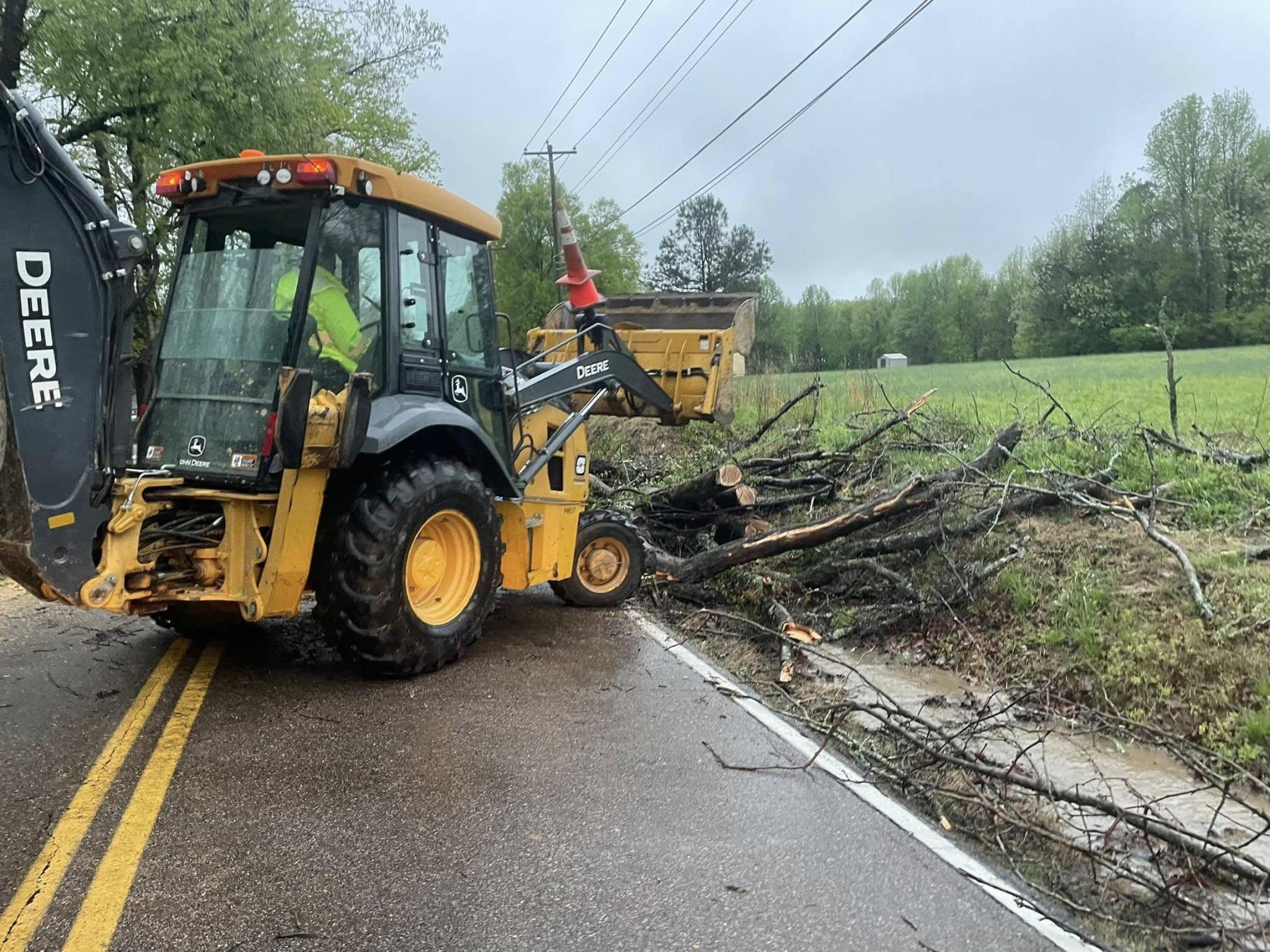
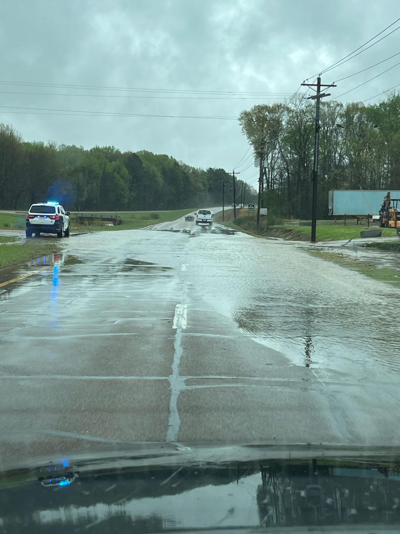
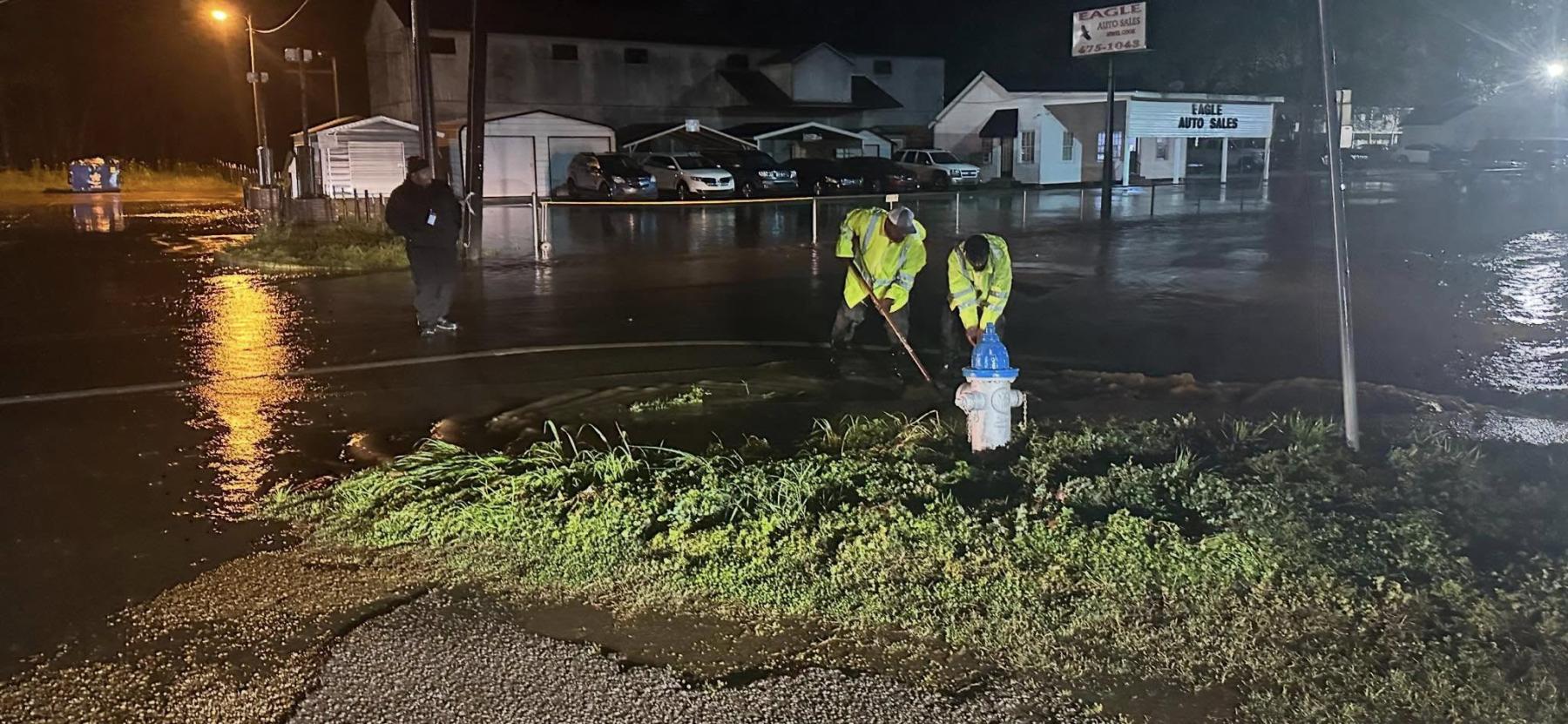
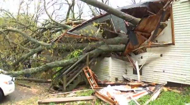
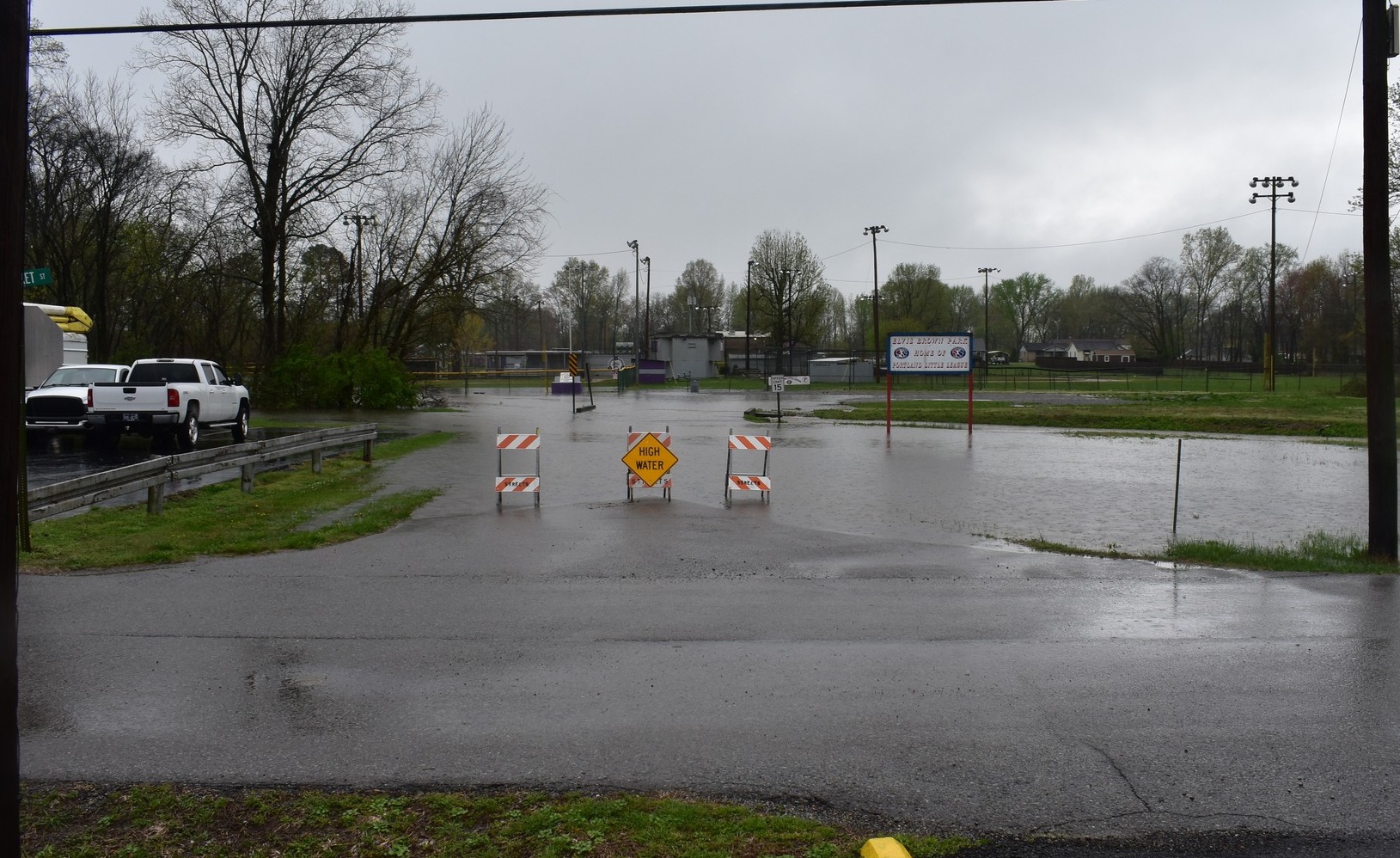
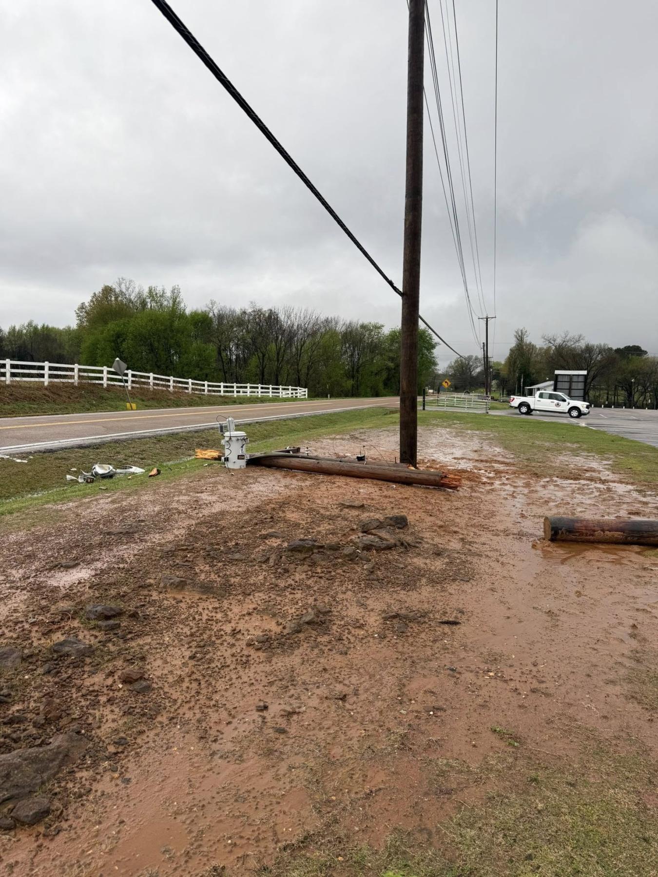
Interstate 65 was temporarily closed near Berry Hill due to flooding Friday while I-40 was closed following debris from the Saturday storms. Roads were also closed due to flooding and storm-related damage in Clarksville, Collierville, Columbia, Fairview, Gallatin, Gates, Germantown, Hendersonville, Huntingdon, McKenzie, Millersville, Mt. Juliet, Nashville, Paris, Portland, Savannah, and Vanleer. A peak of more than 15,400 power outages were reported statewide early on the morning of April 3 with a peak of 70,000 on April 5 following continued storms.
Storm damage also impacted water and wastewater services in West Tennessee. The Henderson, Munford, and Lauderdale County water departments were put under a boil water advisory while the Grand Junction Water Department had no water due to storm damage. Wastewater systems in Decaturville, Henderson, Huntingdon, Paris, Selmer, Springfield, and Chester, Decatur, Fayette, Henderson, and Humphreys counties all reported critically high water levels that had either inundated or damaged wastewater treatment plants.

Ongoing flooding prompted school closures and delays throughout the state on Monday, April 7, including in the municipalities of Bradford and Trenton as well as schools in Carroll, Cheatham, Clarksville-Montgomery County, Dickson, Grundy, Hardeman, Haywood, Henry, Hickman, Houston, Humphreys, Jackson-Madison, Perry, Robertson, Stewart, and Weakley counties.
The United Way of Greater Nashville has set up a 2025 Disaster Relief Fund to help those in Middle Tennessee impacted by the storms. In West Tennessee, donations are being taken at the Gibson County 911 center, Hardeman County Baptist Association, Hardeman County Schools, Jackson State Community College, McNairy County Ag Event Center, Selmer Community Center, and University of Tennessee Martin Parsons Center.