BluewaysTN seeks local input to develop recreation, tourism
By KATE COIL
TT&C Assistant Editor
A new blueways master plan is bringing state funding and resources to municipalities seeking more recreation, tourism, and economic development along 15 major waterways in Tennessee.

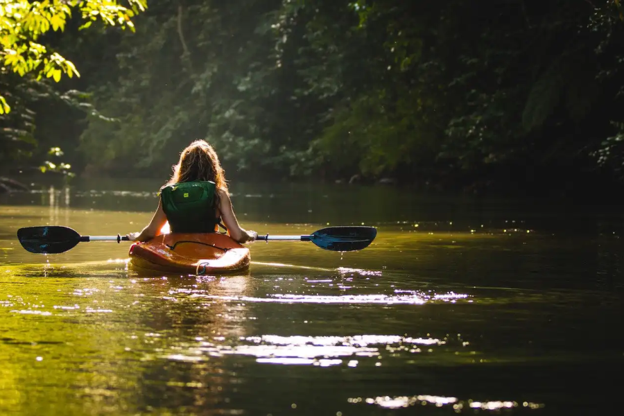
The BluewaysTN initiative was outlined in Gov. Bill Lee’s 2024 State of the State address with the ultimate goal of strategically conserving, developing, and supporting recreational waterways. A blueway is another name for a water trail or water-based recreational corridor, often designated for activities such as kayaking, canoeing, boating, fishing, and other water-related activities.
For the initiative, five major waterways were selected in each of the state’s three grand divisions. The Hatchie, Wolf, Middle Fork Forked Deer, South Fork Forked Deer, and Obion rivers were selected for West Tennessee. In Middle Tennessee, the Duck, Buffalo, Caney Fork, Sequatchie, and Harpeth rivers were selected. In East Tennessee, the initiative will focus on the Hiwassee, Clinch, French Broad, Nolichucky, and Emory rivers.
Brian Clifford, deputy commissioner for the Bureau of Conservation within the Tennessee Department of Environment and Conservation (TDEC), said the initiative is looking at conservation, access, and community engagement along these waterways. A $15 million investment from the Tennessee General Assembly and Gov. Bill Lee will focus on the initial 15 rivers.
“Tennessee has more than 60,000 miles of rivers and streams, so we knew we were unique in the country in terms of waterways,” Clifford said. “Coming from the Appalachian Mountains in the east to the Mississippi Delta in the west, we have waters for everyone, whether you want extreme whitewater adventure or a nice slow paddle. We realized we needed to do something with our waterways, which led to conversations across the state and mainly in rural communities about what they wanted to see in their outdoor spaces.”
Jamison Sliger, blueways coordinator with the Office of Outdoor Recreation, said the 15 rivers were selected by a steering committee based on how suited to development they are, the level of development already existing on the rivers, and if the waterways are accessible year-round. However, the hope is that the initiative will eventually expand.
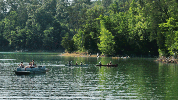
Clifford said just about every community talked about recreation on local waterways, showing there is a statewide demand for more blueway development. The state is working on a plan for both the overall initiative as well as deeper dives into each of the priority rivers. Part of the planning process includes asset development, access points, signage, branding, wayfinding, and on-river information.
“We believe the coverage reaches 92 of the state’s 95 counties based on reasonable drive time to access points,” he said. “Benefits we hope to see out of the program include health improvements, tourism, economic development, local job creation, and conservation efforts around these rivers. A big goal is to make rivers a destination people want to come to. If visitors come, they are going to spend money on gas, food, guides, equipment, and hospitality. That money stays in the community.”
Sliger said the statewide planning phase is largely complete with focus shifting to specific plans for individual rivers. Based on survey feedback from communities, Sliger said TDEC will work with a planning firm to develop recommendations for how each river should be developed.
“Each river has its own DNA, waterflow, culture, and heritage,” he said. “We talk to people who grew up on these rivers, fishing with their grandfathers, and learning to swim. We want to keep telling the stories of these communities via blueways. Our planners are out in the field right now looking at the rivers and classifying them. With that data, we are going to create a public-facing landing page so people can plan their trips depending on what kind of rapids they want to experience and how long they want to spend on the water.”
Sliger said one of the biggest barriers they have discovered to blueway recreation is a lack of information.

“People need to be prepared when they get there to enjoy the trip,” he said. “Blueways are a bit different than hiking trails. If you don’t enjoy a hiking trail, you can turn around and go back to your car. If you’re on a river, that’s a little harder.”
Through data collection, Sliger said more than 380 existing access points have been identified across the 15 rivers, as well as where future access points could be developed. Many of these enhancements are in more urban areas, and Sliger said there is a goal of developing new and enhancing existing access points in more rural communities.
Another asset being developed as part of the project is mapping streambanks to determine their impact on water quality. The map will show potential risk areas so that mitigation projects, like riparian buffers, can be developed. The tool will be available to local communities and agencies like USDA and utilities.
Sliger said the initiative also aims to get local officials to think about their rivers in new ways.
“These rivers are staples in these communities, and more than likely the primary reason for the location of these communities. A river is a natural resource, providing power and a way to travel. As we have expanded technology, we are getting away from rivers for those original needs, but they now fill a recreational need, which is good for our health. This natural resource can help both local residents and visitors. Having leadership buy-in helps us build a future for these blueways that is environmentally sound, with stewardship and recreation.”
While some conversations are already underway with local officials, Sliger said TDEC is eager to assist community leaders who want to get involved in the initiative. He encouraged those leaders, residents, and business owners to also take the survey.
“The more data we have, the more information we know, and the better recommendations we can make,” Sliger said. “The notion and movement for this is really spurred from the communities and our citizens. The more input and buy-in we have, the more we can get right. Once we are done with these individual river recreation plans, they will be available to local governments who can then take those plans to apply for recreation grants that our office provides.”
To learn more about the initiative and how to participate, contact Jamison Sliger at 615-313-5165 or Jamison.Sliger@tn.gov.