New state parks to provide economic, tourism opportunities statewide
By KATE COIL
TT&C Assistant Editor
Tennessee is welcoming the addition of eight new state parks, boosting recreational, tourism, and economic development opportunities for multiple communities.
Since 2023, Gov. Bill Lee’s conservation strategy has called for the addition of more new state parks than any other previous administration, according to the Tennessee Department of Environment and Conservation, which oversees the state park system.
“Tennessee continues to invest in a conservation strategy for our state’s future, and Tennessee State Parks are a cornerstone of our efforts,” said Gov. Bill Lee. “Tennessee’s natural beauty and rich resources drive tourism and our economy, particularly in rural areas, and we welcome Tennesseans and visitors alike to enjoy all that the Volunteer State’s great outdoors have to offer.”
State parks had an economic impact of $1.9 billion in 2024, including $111.8 million in state taxes and $22.1 million in local tax revenue. Additionally, some 13,587 people are employed by state parks, generating $550 million in household income.
“We are proud of the impact our state parks have on the Tennessee economy,” said David Salyers, commissioner of the Tennessee Department of Environment and Conservation. “We are grateful to Governor Lee and the Tennessee General Assembly for having such vision and commitment to conservation, and the figures show how that works for all Tennesseans.”
In addition to spending on gas, food, and overnight stays, state parks can provide opportunities for recreational guide and outdoor equipment businesses in communities. Local conservation efforts also tie in directly to preserving the unique landscape of each park for visitors to enjoy.
Recreational opportunities in the eight new parks range from whitewater rafting and paddling sports to cycling and mountain biking, hiking, camping, fishing, and more. While some of these parks have already opened to the public, others have been announced and are in the process of being developed.

Devil’s Backbone
Location: Hohenwald
Opening Date: TBD
Offerings: Cycling, scenic drives, camping, hiking
Developed from the 950-acre Devil’s Backbone State Natural Area, this state park along the Natchez Trace Parkway will preserve the rich biodiversity of Tennessee’s West Highland Rim. The natural area was established in 1997 to protect the area’s impressive natural beauty and provides a popular hiking loop just off the Natchez Trace.
The current 3-mile hiking trail at Devil’s Backbone features a 393-foot elevation change through forested ridges and hollows, including oak-hickory forests, beech-tulip poplar stands, and sycamore groves. Plans for the park include $20 million to enhance the trail system, improve public access, develop overnight camping, and expand recreational offerings. Staff will include a park manager, gift shop clerk, and maintenance and campsite personnel.
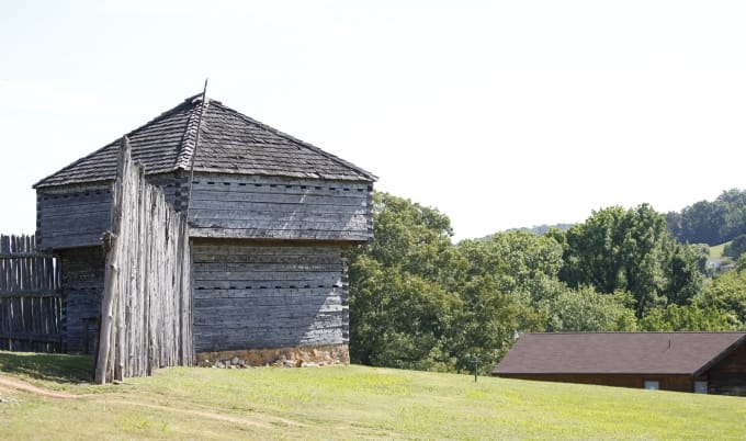
Fort Southwest Point
Location: Kingston
Opening Date: TBD
Offerings: Historical interpretation, education
Located along the Clinch River and Watts Bar Lake in Kingston, Fort Southwest Point was the site of a federal frontier outpost that operated from 1797 until 1811 and played a vital role in the early history of Tennessee. Cherokee Agent Col. Return J. Meigs was in charge of the fort from 1800 until 1807 as more settlers came into the newly established state. Fort Southwest Point was frequently used as a waystation for early migrants and others traveling between Knoxville and Nashville. Eventually, merchants in the city of Kingston offered supplies to travelers, and the fort was no longer needed.
Archaeological surveys conducted at the site in the 1980s revealed that the area was occupied by Native American groups as far back as the 1350s. Today, a reconstructed fort based off archaeological excavations stands there, along with a museum showcasing artifacts. The fort has also been the frequent focus of historical re-enactments and events. Presently operated as a city park by the city of Kingston, the 39.7-acre site will become a state historic park as amenities are added. The state has allocated $659,000 for the project, including the hiring of four staff members and the development of recreational opportunities and amenities.
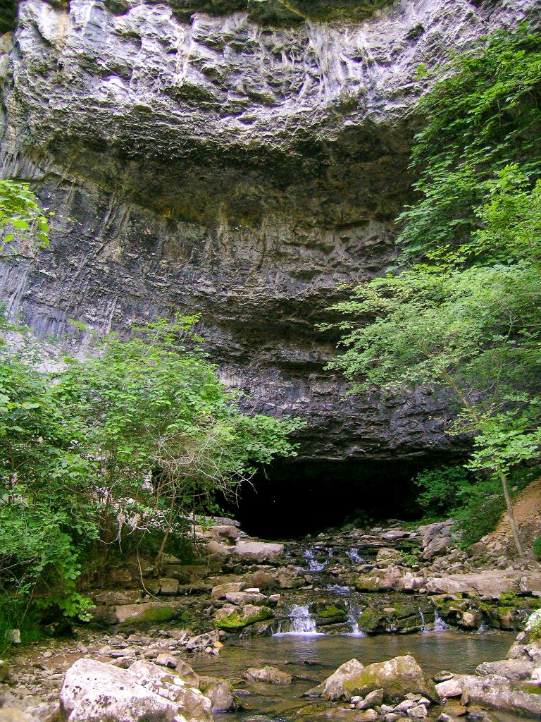
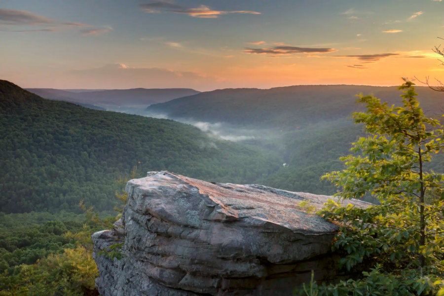
Head of the Crow
Location: Sewanee, Winchester
Opening Date: TBD
Offerings: Hiking, caving, spelunking, hunting, fishing,
Created from 4,258 acres, this state park was once a noncontiguous portion of South Cumberland State Park. The new park was formed to improve land management and ease navigation for tourists and emergency responders. The park is named for the headwaters of Crow Creek and will include much of what was the Lost Cove area of South Cumberland. The park will also include four other state-protected sites: the Sherwood Forest State Natural Area, the Mr. And Mrs. Harry Lee Carter State Natural Area, Natural Bridge State Natural Area, and Hawkins Cove State Natural Area.
The state park will include a significant cave system with an underground river, the 25-foot-high sandstone Natural Bridge, and several hiking trails. Numerous ancient artifacts have been found within the deep cave system, which has entrances at Lost Cove, Buggytop Cave, and Peters Cave. Additionally, the area is home to several rare species including the Morefield’s leather flower, Eggert's sunflower, the painted snake coiled forest snail, and others. The state has allocated $25 million to construct a visitor center, maintenance facility, park amenities, and related infrastructure.
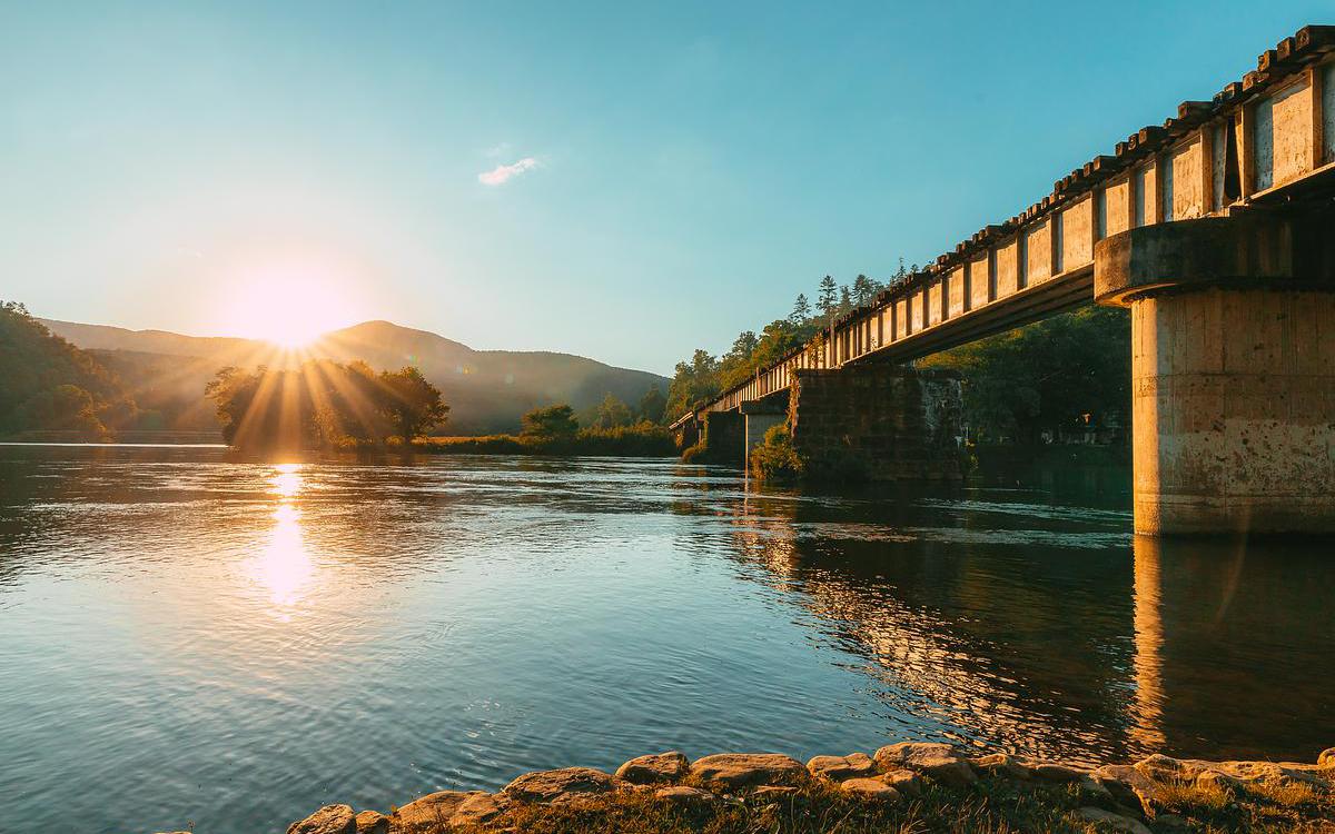
Hiwassee Scenic River
Location: Etowah
Opening Date: Sept. 20, 2025
Offerings: Birding, boating, fishing, hiking, primitive camping, and nature photography
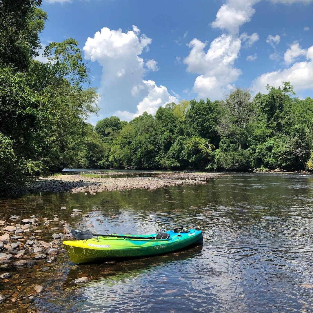
Hiwassee Scenic River State Park is one of two new state parks created by dividing the former Hiwassee-Ocoee State Park. The 23-mile stretch of the Hiwassee River stretching from the North Carolina border was the first river managed in the State Scenic River program, offering Class II and Class III rapids. Numerous boat launch ramps enable access for boating, canoeing, kayaking, paddling, and whitewater rafting. Numerous outfitters and rafting vendors can also provide guided trips down the river for visitors.
Additionally, a portion of Tennessee’s John Muir Trail winds through the river gorge. There are popular fishing streams for anglers of all ages and abilities with largemouth bass, yellow perch, catfish, and brown and rainbow trout. More than 100 species of birds are also known to live within the park, making it a popular destination for birders and nature photographers.
Ocoee River State Park
Location: Benton
Opening Date: Sept. 20, 2025
Offerings: Birding, canoeing, kayaking, paddling, whitewater rafting
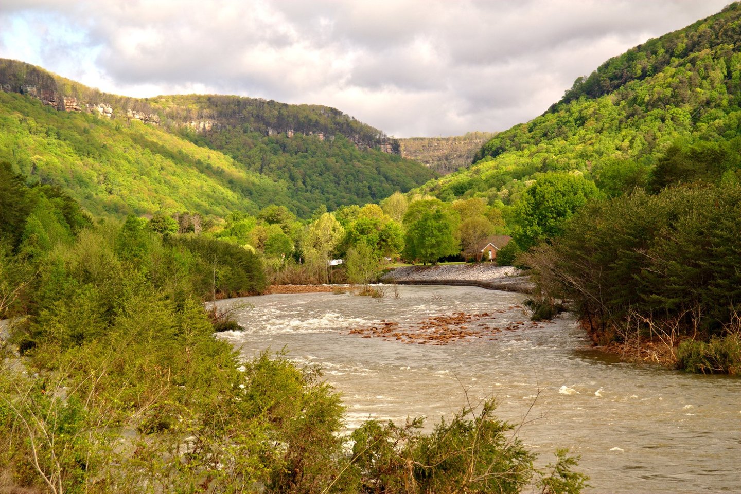
The second park formed out of the former Hiwassee-Ocoee State Park, this park is home to the internationally recognized Ocoee River, which was the site of the whitewater slalom competition for the 1996 Atlanta Olympics and one of the first hydroelectric power sources in the state. Floating, canoeing, and rafting continue to be the most popular activities with a range of easy Class I to some of the most difficult Class VI rafting waters east of the Mississippi. The 10-mile stretch of river offers opportunities for all.
Visitors also enjoy hikes to waterfalls, swimming holes, picnic spots, and fishing for largemouth bass, yellow perch, catfish, and trout. More than 100 species of birds have also been observed in the park, including great blue herons, bald eagles, spotted herons, mockingbirds, swallows, buntings, and woodpeckers. The Sugarloaf Mountain Day Use Area and Rhododendron Trail from the Ocoee Whitewater Center are two popular destinations for birds in the spring and fall.
Middle Fork Bottoms
Location: Three Way
Opening Date: Aug. 12, 2024
Offerings: Birding, cycling, fishing, hiking, nature photography, paddling
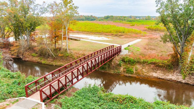
Created out of an 850-acre natural area, Middle Fork Bottoms provides nearly 5 miles of paved trails for hiking and biking, opportunities for kayaking and canoeing, a 10-acre lake stocked for fishing, other fishing spots along the river, wildlife areas, and even a place to train retriever dogs for wetland hunting. Located along the Middle Fork of the Forked Deer River, the original recreation area was created to manage agricultural flooding caused by the channelization of the Hatchie River. What began as a flood resiliency project now offers unique recreational opportunities between Jackson and Three Way.
The wetlands, upland prairies, bottomland hardwood forests, cypress groves, woodlands, grass marshes, and an oxbow lake found in the park are small examples of the wider ecosystems prevalent throughout West Tennessee. The park is also home to two nationally endangered species – the whorled sunflower and Indiana bat – along with several threatened species including the northern long-eared bat, Lamance iris, blue sucker, red star vine, and lake-bank sedge. Future plans for the park include a visitor’s center, boardwalks, boat launches, and more.
North Chickamauga Creek Gorge
Location: Signal Mountain, Soddy-Daisy
Opening Date: Sept. 5, 2024
Offerings: Camping, cycling, fishing, hiking, kayaking
At more than 6,000 acres, this state park contains the 10-mile long, deep gorge cut into the sandstone of Walden’s Ridge by Chickamauga Creek. Formerly a natural area managed by Justin P. Wilson Cumberland Trail State Park, this park is billed as the southern gateway to the Cumberland Trail. As a result, the park is also vital to efforts to develop the Great Eastern Trail, an American Hiking Society project aiming to create a new long-distance hiking trail between Alabama and New York. Visitors can enjoy steep slopes, sandstone bluffs, and rich coves as well as highly diverse plant and animal communities. There are ten state and federally threatened or endangered plants in the park with frequent sightings of bald eagles and peregrine falcons.
Once a major logging industry site, tulip poplar, yellow buckeye, and basswood trees are returning to the area, along with oak-hickory and oak-pine forests. Upland ponds, sandstone glades, and barrens add to the area’s color and beauty. Visitors can enjoy 20 miles of hiking trails, including part of the 300-mile Cumberland Trail. Additionally, the park offers backcountry camping and mountain biking trails. Upcoming enhancements to the park include parking areas, a visitor’s center, ADA viewing platform, and trail improvements.
Scott’s Gulf Wilderness
Location: Sparta
Opening Date: May 9, 2025
Offerings: Camping, canoeing, fishing, hiking, hunting, paddling, rafting
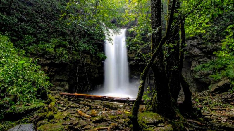
Officially the 60th park in the Tennessee State Park system, this canyon situated along the Caney Fork River stretches for approximately 18 miles from the Cumberland Plateau down to the eastern Highland Rim and is home to one of the largest, undisturbed deciduous forests in the state of Tennessee. Dotted with numerous waterfalls, caves, geological formations, and Class IV and V whitewater rapids, the 9,500-acre Scott’s Gulf Wilderness State Park integrates areas formerly managed by Fall Creek Falls – including the Virgin Falls State Natural Area, Lost Creek State Natural Area, Dog Cove Historic Area, and Hardie Trailhead – into a new state park.
The ruins of an old mining town, karst caves, panoramic views, and dozens of waterfalls can be found in this primitive wilderness. Hunters and fishers have long enjoyed this tranquil landscape with 6,500 acres of the park open to hunting. The park also provides 14 primitive campsites as well as hiking trails to a variety of unique natural features. The park includes river access to the Caney Fork at Mitchell Ford. Blending history and natural beauty, plans for the development of this park include a visitor center on Bon Air Mountain – the former site of a luxury hotel – as well as future trails, overlooks, restrooms, and campgrounds.