TDEC unveils new water quality maps
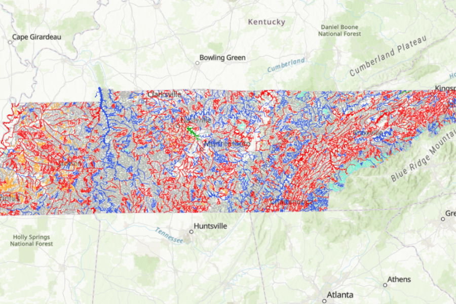
A new map is highlighting sources of pollution in state waterways to improve water quality. The Tennessee Department of Environment and Conservation unveiled a map that helps monitor water quality in streams, rivers, and reservoirs across the state. The map shows that 19,000 miles of the state’s 60,000 miles of streams and rivers are listed as “impaired,” meaning they have at least one form of pollution or alteration in the water. Some of the most common causes of pollution include habitat degradation, E. coli, soil erosion from agriculture and construction, and run-off of nutrients from fertilizers or pesticides. The agency is hoping the map can be an important resource for water quality monitoring.