Clarksville deploys LiDAR for safer streets
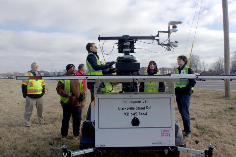
Clarksville’s Street Department has begun to deploy Light Detection and Ranging (LiDAR) remote sensing technology in its pursuit of safer travel for the public throughout the city. Mayor Joe Pitts ceremonially turned on the technology to launch the program that partners the Clarksville Street Department, Austin Peay State University, and Vanderbilt University to better study how traffic incidents occur and what can be done to prevent them. LiDAR technology uses pulsed light not visible to the human eye to precisely measure distances to objects, creating detailed 3D models. LiDAR technology is not to be confused with license plate readers, red light cameras, speed trailers, or other devices used in law enforcement that most motorists are likely more familiar with. It will allow members of the Street Department to understand the habits of all travelers (cars, pedestrians, cyclists, etc.) and how these behaviors can be used to achieve safer streets and highways. The remote sensor will rotate through various locations in the city every couple of weeks to study various street and highway intersections of interest. The data collected can be used to better inform signal timings to optimize traffic flow and ultimately help reduce vehicle crashes, as well as assist the City with future planning for multi-modal pathways.